


News Desk
The News Desk provides timely and factual coverage of national and international events, with an emphasis on accuracy and clarity.
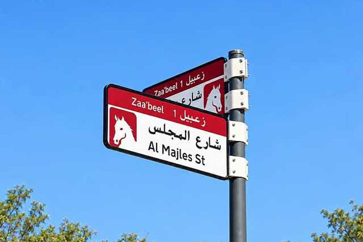
Dubai’s new addressing system brings unified designs, updated colors and QR codes to signs for communities, streets and properties.
RTA
Dubai’s new street signs, neighborhood boards and house plates will carry updated colors, unified designs and QR codes across 186 areas by 2030, Gulf News reported. The Supreme Committee for Urban Planning, the Roads and Transport Authority (RTA) and Dubai Municipality are leading the project. It starts in 2026 and aims to make streets and properties easier to identify.
What is changing under Dubai’s new addressing system?
The new addressing system gives Dubai one visual identity for community, street and property signs. It covers area signs, internal street name signs, house number plates and QR codes. Designs and colors will be coordinated so addresses look consistent for residents, motorists and visitors across the emirate.
What will the new Dubai street signs include?
The update covers four types of sign
- Area identification signs for communities and neighborhoods
- Internal street name signs within residential and other areas
- House number plates showing Makani numbers and QR codes
- QR codes on signs that link to more information about locations, street names and nearby attractions
The new signs will follow coordinated designs and colors. The aim is to help people identify streets, communities and individual properties more easily.
Which Dubai areas will get the new signs first?
The first phase begins in 2026. More than 2,000 signs will be installed or replaced in five areas:
- Za’abeel 1
- Za’abeel 2
- Nad Al Sheba
- Al Khawaneej 1
- Nazwa
The wider rollout starts in the fourth quarter of 2026. It will cover 186 areas across 19 sectors, with completion targeted for 2030.
Areas will be prioritized based on several factors:
- Population density
- Urban growth
- Traffic activity
- Residential and tourist attractions
- The share of streets not yet formally addressed
What information will the new QR codes show?
Each house plate will display the property’s Makani number, Dubai’s unique 10-digit location identifier. A QR code will appear alongside it.
QR codes on other signs will give access to details about sectors and communities. They will also explain the meanings behind street and area names. Users can also find nearby landmarks and points of interest.
In future phases, the new visual identity will extend to bus stops, smart applications and area map boards.
What do Dubai’s existing road sign colors mean?
The project focuses on area identification, internal street names and house plates. It does not replace Dubai’s existing color-coded highway navigation system.
Dubai already uses colors to help drivers tell road types apart:
- Blue: Inter-emirate routes, known as E Routes, such as Sheikh Zayed Road (E11) and Emirates Road (E611). These signs carry the UAE’s falcon emblem.
- Green: Roads within Dubai, known as D Routes. These signs carry Dubai’s castle road emblem.
- White: Street names in residential communities and neighborhoods. They help residents, visitors and delivery drivers find specific addresses.
- Brown: Tourist destinations, landmarks and places of interest. They often show symbols for the type of attraction.
When will the new Dubai addressing system be completed?
The project will roll out in phases until 2030. By then, the new designs are expected to cover all 186 identified areas.
For residents, the main changes will be more consistent street and community signs, updated house plates and QR codes with extra location information.




Comments
See what people are discussing