

News Desk
The News Desk provides timely and factual coverage of national and international events, with an emphasis on accuracy and clarity.
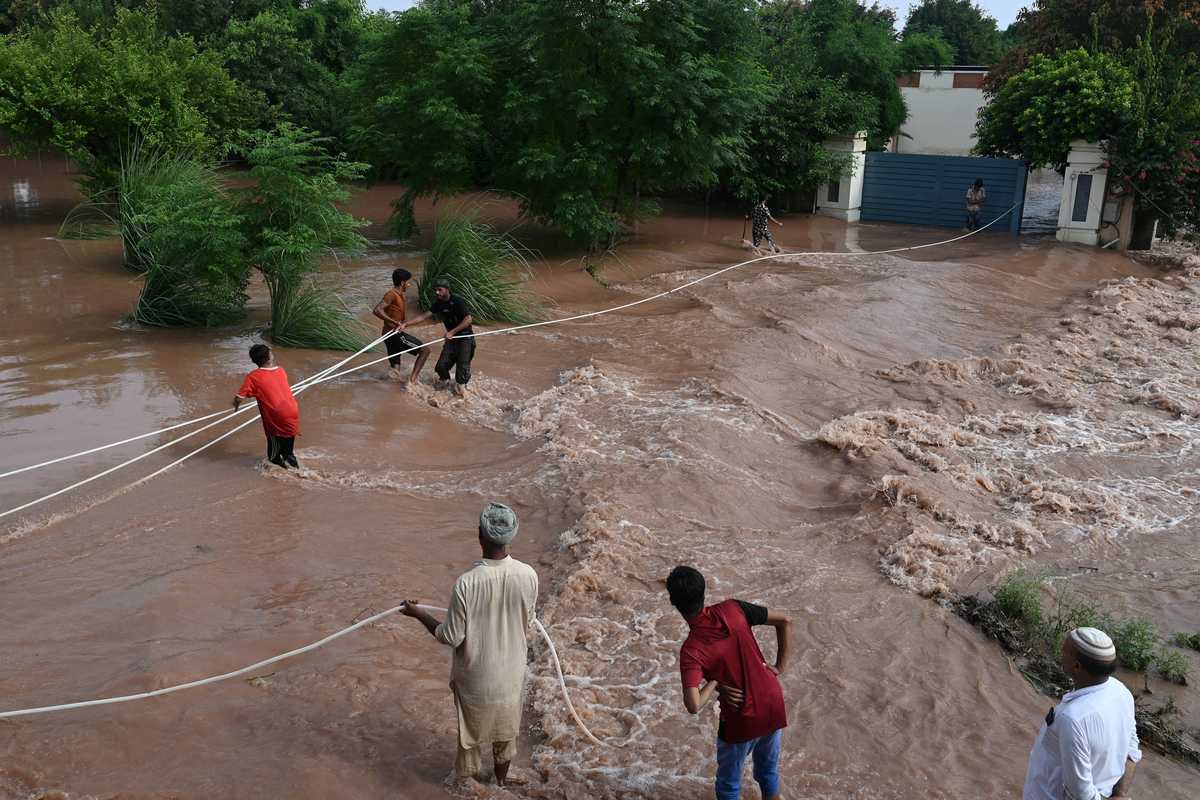
Citizen's wade through the flooded area of Narowal, a town of Punjab province, on August 27, 2025.
AFP
As unprecedented monsoon rains unleash devastating floods across Pakistan’s Chenab, Ravi, and Sutlej rivers, the Pakistan Space and Upper Atmosphere Research Commission (SUPARCO) is leveraging advanced satellite technology to guide emergency response and relief efforts, highlighting the vital role of space-based tools in tackling climate-driven disasters worldwide.
The floods, worsened by heavy rains in upstream catchment areas and the release of excess water from dams in India on the Ravi, Beas, and Sutlej rivers, have swept across more than 1,400 villages, affecting over 1.2 million people, according to the Provincial Disaster Management Authority (PDMA).
More than 248,000 residents have been displaced, while over 148,000 livestock were relocated to safer grounds. Forecasts from Pakistan’s National Disaster Management Authority (NDMA) indicate that additional rainfall is expected Thursday across parts of northeast Punjab, Khyber Pakhtunkhwa, Pakistan-administered Kashmir, and Gilgit-Baltistan, raising concerns of further inundation.

SUPARCO’s Space Application Centre for Response in Emergency and Disasters (SACRED) has been instrumental in mapping and monitoring the affected areas, the statement from the commission said.
“Using pre- and post-flood satellite imagery, authorities can now see submerged settlements, damaged roads, and disrupted communication networks in real-time,” explained SUPARCO spokesperson Maria Tariq. Such space-based information allows rapid assessment of the most vulnerable zones, guiding relief operations and prioritizing rehabilitation efforts.
In addition to live imagery, SUPARCO prepared detailed maps highlighting potentially affected crops, infrastructure, and built-up areas using simulated flood extents developed under its National Catastrophe (NatCat) Model project, funded by the National Disaster Risk Management Fund (NDRMF).
The commission’s experience in disaster response is well-established, having previously supported relief operations during floods in Buner (KP) and Babusar Top (GB), some of the worst-hit regions in Pakistan, the statement added.

Through its DisasterWatch Portal, SUPARCO tracks natural hazards, providing timely and satellite information to NDMA, provincial disaster authorities in Punjab, KP, and Gilgit-Baltistan, and other stakeholders. "This monitoring allows decision-makers to stay updated on flood developments and take proactive measures to minimize loss of life and property."
The NatCat Project, a flagship initiative under NDRMF, equips Pakistan with probabilistic risk assessment tools for a range of natural disasters, including floods, droughts, cyclones, tsunamis, heatwaves, landslides, and earthquakes. The project supports disaster preparedness, risk reduction and the development of disaster risk financing strategies nationwide.


Comments
See what people are discussing