

Dubai Desk
The Dubai Desk reports on major developments across the UAE, covering news, culture, business, and social trends shaping the region.
MBZ-SAT was successfully launched on Jan 14
MBRSC
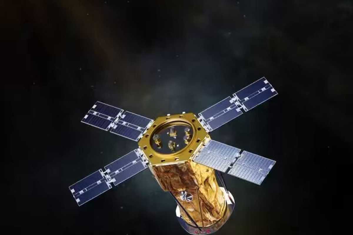
A small satellite from a small country is making big promises: MBZ-SAT, the UAE's latest space mission, is designed to do what few others can: provide razor-sharp images of Earth, fast.
Why does that matter? With an increasing number of disasters around the world — floods, wildfires, and urban sprawl —seeing clearly is half the battle.
Named after Sheikh Mohamed bin Zayed Al Nahyan, the President of the UAE, MBZ-SAT stands as the most advanced commercial satellite of its kind in the Middle East.
Yet MBZ-SAT is not a satellite of vanity. Its mission is grounded, quite literally, in the Earth’s most pressing needs: climate change, disaster management, and agricultural monitoring.
The UAE’s journey into space is relatively new, but it has been swift and intentional. Less than a decade ago, the nation launched its first homegrown satellite, KhalifaSat. Then came the Hope Probe, which reached Mars in 2021, earning the UAE a place among the world’s space pioneers.
MBZ-SAT builds on that legacy. But what stories will it tell? And how will they shape the way we see ourselves?
What does MBZ-SAT do?
Launched on SpaceX’s Falcon 9 rocket from California on January 14, MBZ-SAT is packed with tech that takes Earth observation to the next level.
It can capture ultra-detailed images—doubling the precision of earlier satellites—and deliver them in under two hours. According to the Mohammed Bin Rashid Space Centre (MBRSC), it also produces 10 times more images at four times the speed. In simple terms, MBZ-SAT can take incredibly detailed pictures of Earth — not just your average satellite imagery, but sharp enough to show the effects of climate change, monitor crops, and track urban expansion.
Here’s why that matters:
- Disaster response: During floods, wildfires, or earthquakes, MBZ-SAT can map the damage in record time, speeding up relief efforts.
- Urban planning: It tracks infrastructure growth, city layouts, and population density with unmatched precision.
- Climate monitoring: From deforestation to melting ice caps, the satellite provides crucial data for addressing environmental change.
- Agriculture: Farmers can predict crop yields, monitor soil health, and optimize water usage using satellite imagery.
Why is MBZ-SAT such a big deal?
1. Hi-Res images in under 2 hours
At 750 kg and about the size of a small truck, MBZ-SAT is one of the most advanced Earth observation satellites out there.
Here’s the impressive part: MBZ-SAT’s camera is so sharp it can capture images with twice the precision of previous models. And it’s fast — its onboard processing system can deliver high-resolution images in under two hours.
These images can help monitor the environment, manage urban infrastructure, and even assist with disaster response, giving decision-makers critical information when it matters most.
Case in point: Following the 2011 Tōhoku earthquake and tsunami in Japan, Earth observation satellites played a crucial role in disaster response. The Japanese space agency, JAXA, activated the International Charter on Space and Major Disasters, facilitating the sharing of satellite imagery with rescue and aid organizations. This imagery enabled authorities to assess the extent of inundation, map affected areas, and plan effective relief operations.
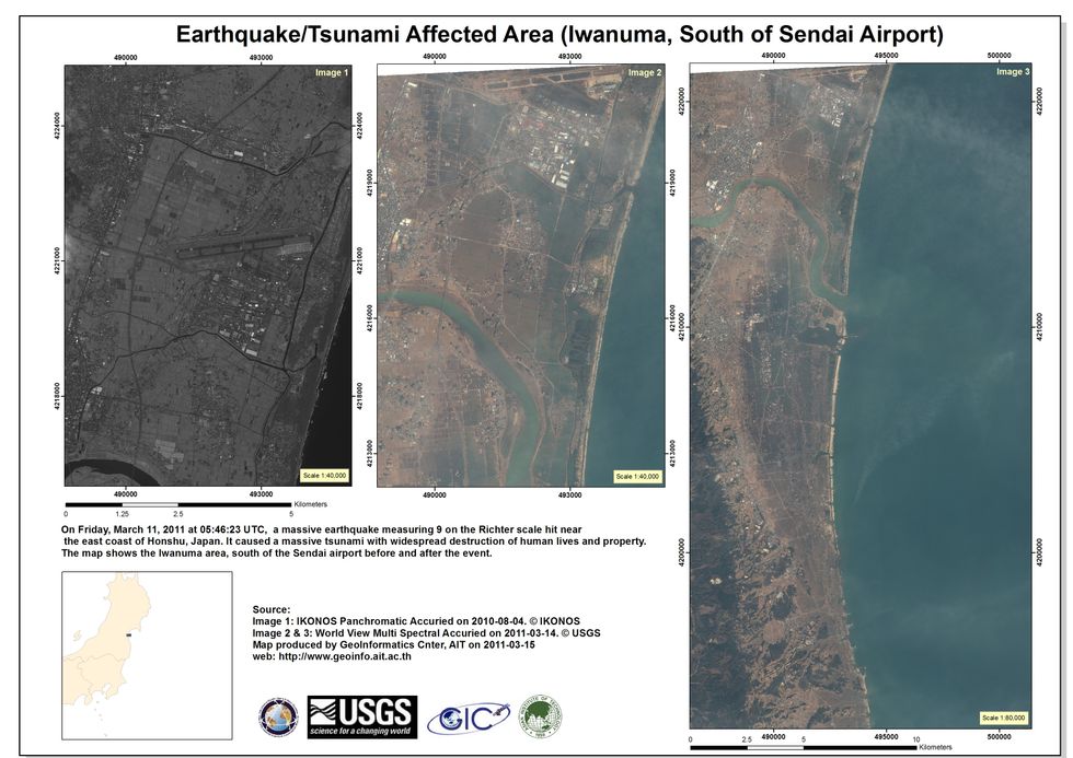 Satellite images showing before and after scenes of the 2011 Tōhoku earthquake and tsunami in Japandisastercharter
MBZ-SAT is designed to deliver such capabilities with even greater speed and precision, potentially revolutionizing disaster response and environmental monitoring in the Middle East and beyond.
2. Made in the UAE
Unlike many countries that outsource satellite construction, MBZ-SAT was developed entirely by Emirati engineers at the Mohammed Bin Rashid Space Centre (MBRSC). Approximately 90% of the satellite’s mechanical structures and a significant portion of its electronic components were manufactured within the UAE. Local companies such as Strata, EPI, Rockford Xellerix, Halcon, Falcon, and EGA contributed their expertise to the project, showcasing the nation’s growing industrial capabilities, according to the UAE Media Office.
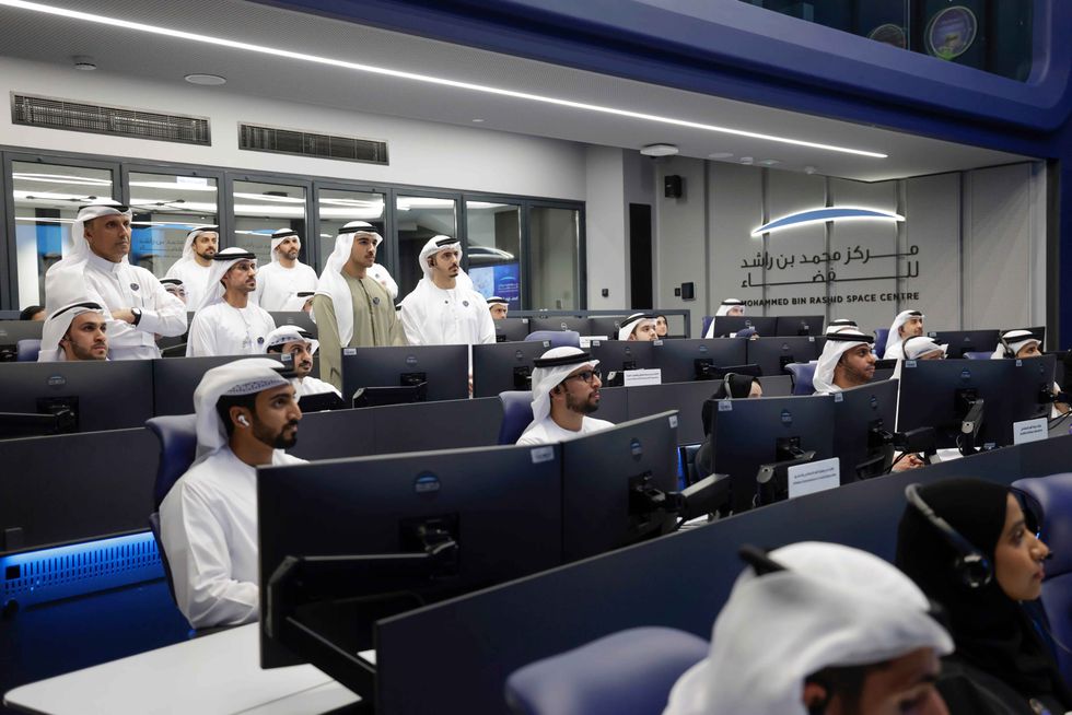 MBZ-SAT was built by Emirati engineersMedia Office
This isn’t just about national pride—it’s about fostering a local space industry. The project has passed essential skills to Emirati engineers, laying the groundwork for future innovation.
“Through every advancement, we’re empowering future generations to dream bigger and reach farther,” said Salem Humaid AlMarri, Director General of MBRSC.
3. A new era of Earth observation
As industries worldwide increasingly rely on satellite data, MBZ-SAT promises to be a game-changer. Its high-speed, high-resolution capabilities mean governments, scientists, and industries can make smarter decisions — whether responding to natural disasters or planning sustainable urban growth.
MBZ-SAT may be small, but its vision for Earth is nothing short of revolutionary.


Comments
See what people are discussing